iOS App for wildfires
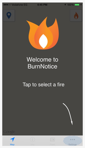
BurnNotice is an in-house project. Several of us have lived in the Mountain West and found it cumbersome to assemble all of the information sources into a cohesive picture, so we built an app that fetches data from GeoMac Wildland Fire Support, InciWeb, CalFire, Twitter, and weather stations then combines it into a seamless experience that allows users to explore big fire events on their iPhone or iPad. We used CartoDB to support the mapping capabilities with PHP, PostGIS, and cron handling the automatic updates, database cross-walking, and spatial pre-processing. The app is written with Swift in the native iOS environment and uses Google Maps to render the tightly curated data housed in CartoDB.
This project will receive ongoing development. There are a multitude of additional, state level data sources to include that are of great value, as well as additional ways to interact with the data. Look for a discussion of the latest improvements and updates on this page or in iTunes as we post version updates.
Most Recent Update!
We have drastically increased the level of data we are receiving from CalFire. This will improve availability of information for fires that are not monitored directly by the national database, InciWeb. We have also made small user interface improvements.
For the future, we plan to begin including fires from InciWeb that do not yet have GeoMAC spatial boundaries. This will allow users to still receive all of the other relevant information, while waiting for boundary to be published.
Suggestions?
If you have suggestions, feedback or requests for BurnNotice, please send us a note from our Contact page!
If you have suggestions, feedback or requests for BurnNotice, please send us a note from our Contact page!