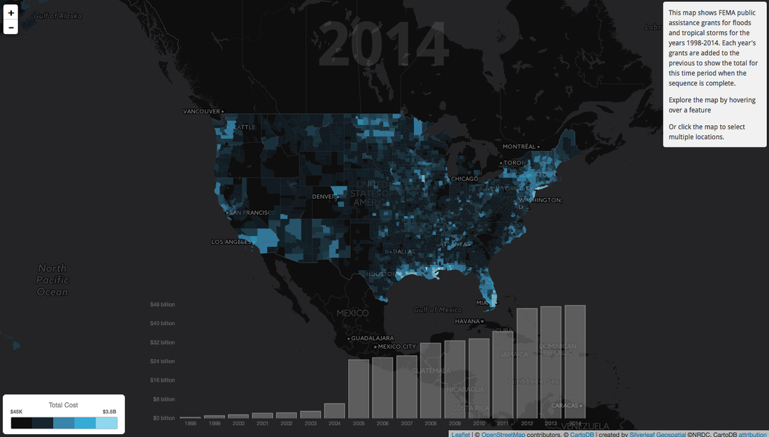
We have worked on several projectswith Natural Resources Defense Council. One of the most dynamic is an animated web map and charting application that allows visitors to explore how $48.6 billion in FEMA Public Assistance Grants were spent in the wake of floods each year from 1998 to 2014. This tool will be used by both the public and by policy makers to inform decisions about national Flood Protection Standards.
This project gave us the opportunity to play with animating semi-transparent polygon maps, including some unique methods for blending colors as the map layers were added and removed throughout the animation. We used torque.js and chart.js to display an animated bar chart of annual grant expenditures along with jQuery to provide easy data interactivity. We provided users the ability to select and receive additive statistics for multiple polygons and to switch between county and state collated visualizations.
This project gave us the opportunity to play with animating semi-transparent polygon maps, including some unique methods for blending colors as the map layers were added and removed throughout the animation. We used torque.js and chart.js to display an animated bar chart of annual grant expenditures along with jQuery to provide easy data interactivity. We provided users the ability to select and receive additive statistics for multiple polygons and to switch between county and state collated visualizations.